R. D. BAILEY LAKE
R. D. BAILEY LAKEDrawer 70,US Route 52 North
(lat:37.608 lon:-81.8101)

Phone:
304 664-3229
R. D. Bailey Lake is located in southern West Virginia, primarily within Wyoming County and named after an esteemed local judge, Robert Daniel Bailey. This reservoir was created by the U.S Army Corps of Engineers with a dam on the Guyandotte River for flood control purposes.
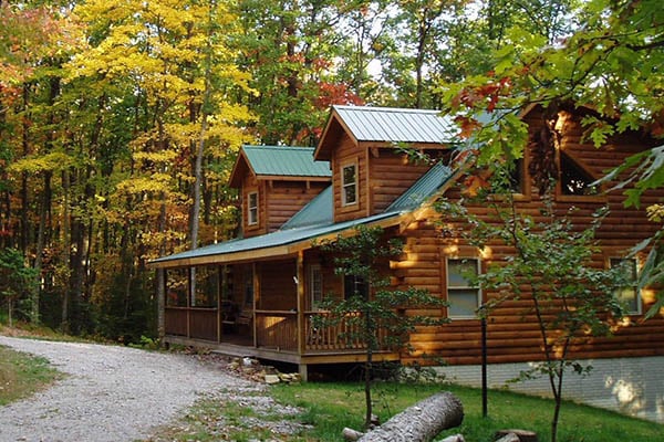
Spanning approximately 630 acres when at full pool level, R.D. Bailey Lake offers various recreational activities such as boating, fishing (notably for bass), hiking trails around its perimeter and hunting opportunities in adjacent public lands.
The project's construction began in 1960s; it reached completion and opened to the public in August 1980 providing both recreation facilities alongside its primary function of flood risk management which has significantly reduced flooding incidents downstream since then.
 Guyandotte Campground
Guyandotte is along the upper branch of the lake and offers electric to full hookup sites. Camground has two loops, playgrounds, restroom, showers and shoreline fishing opportunities.
The campground offers developed shower houses and playgrounds.
Big Branch Shelter
Visitor Center Shelter
Guyandotte Point Shelter
RD Bailey Lake
RD
....moreLocated in Wyoming County, the lake named after Robert D. Bailey, a former state attorney general and Supreme Court justice, is an artificial reservoir created by the U.S. Army Corps of Engineers with construction starting in 1960 and completing in 1980.
The land surrounding the future site was historically used for various forms of agriculture as well as coal mining activities which were prevalent throughout southern West Virginia's history due to its rich natural resources.
Prior ownership details are not widely publicized but typically before such projects commence lands would be owned by private citizens or entities that sell or relinquish rights to federal agencies for development purposes; this area likely followed similar patterns.
Within what became known as Guyandotte Park lies historical features including remnants from early settlers' homesteads along with evidence of Native American habitation prior to European settlement indicated through archaeological finds like tools and pottery shards unearthed during construction phases.
In recent years leading up to it becoming part parkland designated for recreation use included timber harvesting alongside continued small-scale farming until acquisition processes began paving way towards conservation efforts aimed at flood control measures while providing outdoor recreational opportunities.


 Share Your R. D. Bailey Lake Photos (click here)