SUGARLOAF RIDGE STATE PARK
Sugarloaf Ridge State Park contains the headwaters of Sonoma Creek. It runs through gorge and canyon, across the meadow floor, beneath scenic rock outcroppings, and is surrounded at times by redwoods and ferns.
A 25-foot waterfall flows after the winter rains. There is a self-guided nature trail along Sonoma Creek that starts near the picnic area.
With 2700 acres of oak woodland and chaparral, the park has 25 miles of trails for hiking and horseback riding. A Horseback Riding concession is available during the spring, summer, and fall. Reservations for horseback rides can be made through Triple Creek Horse Outfit by calling (707) 933-1600
Deer, gray foxes, the occasional bobcat and coyote can be seen in the park. In spring, wildflowers provide a colorful palette across the green hills.
On a clear day, visitors can see views of the Sierra Nevada and the Golden Gate bridge from the 2729-foot summit of Bald Mountain.
BBs / Inns
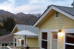
More than a BB - Aurora Park Cottages is your private vacation retreat at the top of Napa Valley. Located in a country setting in beautiful Calistoga - the spa capital of California. FREE CHAMPAGNE AND CHOCOLATES Please tell us you found us on www.stateparks.com and we'll have some chilled champagne and chocolates awaiting your arrival at Aurora Park Cottages.
10.1 miles from park*
Sugarloaf Ridge State Park is located near American Canyon, Napa and Petaluma
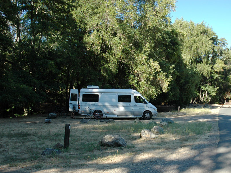
Sugarloaf Ridge State Park offers scenic picnic areas with tables and BBQ grills, nestled among oak woodlands and meadows.
Bald Mountain, Vista, Gray Pine, Meadow Trails 6 mile loop through park with 700-foot elevation gain;shorter and longer loops possibleToday we buy granulated sugar in sacks, but grocers of years ago sold crystallized sugar in a sugarloaf?a conical shape that resembled an upsidedown ice cream cone.
Among the more prominent sugarloaves in Southern California are 9,952-foot Sugarloaf Peak in the San Bernardino Mountains and Sugarloaf Mountain in the Santa Monica Mountains?reportedly inspiration for the Paramount Pictures logo.
In Northern California, a distinguished sugarloaf rising above the wine country is the highlight of Sugarloaf Ridge State Park. Sugarloaf Ridge is part of a length of Coastal Range called the Mayacamas Mountains, which border Sonoma and Napa Valleys.The distinct ridge, volcanic in origin, is impressive?and just a little bit spooky when wrapped in mist or when turkey vultures circle it.
The state park is laced with 25 miles of trail, leading through three distinct ecosystems. Chaparral blankets the high ridges, except for the park?s aptly named high point, Bald Mountain. Your reward for climbing this mountain is a terrific view stretching from the Napa Valley vineyards to the snowy peaks of the Sierra Nevada.
The park?s grassy meadows are bedecked in spring with a multitude of colorful wildflowers from Indian pinks to blue dicks. Also look for lupine, California poppy, cream cups, buttercups and Mariposa lily.
In the canyons watered by Sonoma Creek and its tributaries grow Douglas fir, oak, big-leaf maple, and even a grove of redwood. Swollen by winter rains, Sonoma Creek generates a handsome, 25-foot waterfall that cascades below the park campground.
Depending on time, energy, and inclination, the hiker can fashion several four- to eight mile loops through the state park. For a good introduction to local flora, join the 0.75 mile Creekside Nature Trail. Numbered posts along the trail correspond to park brochure nature descriptions.
Directions to trailhead: From Highway 101 in Santa Rosa, exit on Highway 12 and travel east 11 miles to Adobe Canyon Road. Turn left and follow it four miles to the hikers? parking lot a bit before road?s end.
The hike: From the east end of the parking lot, hit the trail which leads into a meadow and soon splits. Join Lower Bald Mountain Trail, which crosses a meadow, then ascends through an oak and madrone woodland. After a mile?s brisk climb, the path intersects paved Bald Mountain Trail. A strategically placed bench allows you to catch your breath and to gaze out over the park. Proceed right on the road, ascending steeply a 0.25 mile to signed Vista Trail. The intrepid will continue marching up the road, past the turnoff to Red Mountain (2,548 feet) to the summit of Bald Mountain 2,729 feet. From Bald Mountain, enjoy the view of the Napa Valley below, Mt. Saint Helena above. On especially clear days, the panorama includes the High Sierra and San Francisco Bay.
Those forsaking the peak, will join Vista Trail, which drops into a couple of ravines watered by seasonal Sonoma Creek tributaries. Vista Trail serves up promised vistas of Sugarloaf Ridge, then descends through Columbine Meadow. Cross Sonoma Creek, join Gray Pine Trail and cross a meadow. Bordering the meadow is quite a mixture of trees: maples, black oaks, alder and bay.
At a signed trail junction, you can select Meadow Trail, which crosses a meadow and returns you to trailhead.
A less direct way back is to join Hillside Trail which climbs above Sonoma Creek and gives you another perspective ?a northern view?of the state park, then descends to join Creekside Nature Trail near the campground and trailhead.
The non-profit Valley of the Moon Observatory Association provides year-round astronomy education and interpretation programs at the Robert Ferguson Observatory within Sugarloaf Ridge State Park. Program fees vary, some are free with the payment of the park's Day Use Fee. There are three telescopes and the New Generation 40-inch Telescope Project at the Ferguson Observatory which will be one of the largest telescopes dedicated for public viewing.

BBs / Inns
Close to Calistoga, Napa Valley and Lake County Vineyards, and Harbin Hot Springs in the Mayacama Mountains, and 2 hrs away from San Francisco or Sacramento. Backyard Garden Oasis is an exquisite respite for those wanting a nature-filled retreat surrounded by some of Californias most beautiful country.
24.4 miles from park*
The park is about one hour away from San Francisco and seven miles east of Santa Rosa. Address:
2605 Adobe Canyon Road
Kenwood, CA 95452


 Share Your Sugarloaf Ridge State Park Photos (click here)
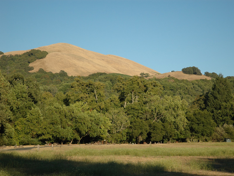