GRAND PORTAGE STATE FOREST
GRAND PORTAGE STATE FOREST
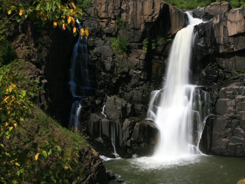
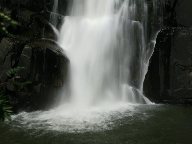
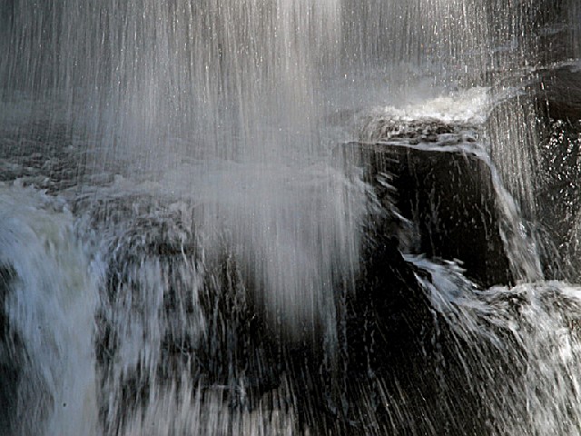
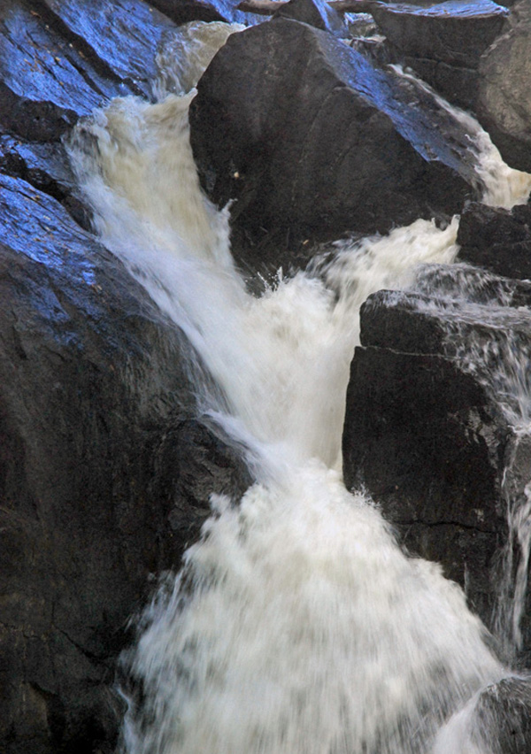
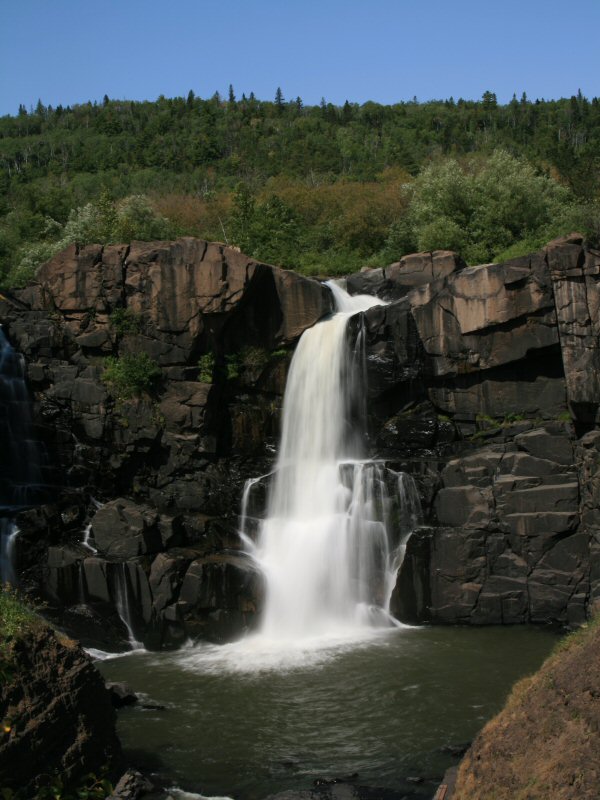
Torrents of wild water plummet 120 feet over the High Falls down to the Pigeon River in this park on the U.S. - Canadian border. The falls, the highest in the state, presented a serious obstacle to river travel, so a "carrying place," or portage, was necessary. American Indians created the ancient nine-mile trail from Lake Superior to bypass the falls. This trail became known as "The Grand Portage." Today, visitors of all abilities can take a one-half mile trail and boardwalk to the falls overlook area. The park is designed for day use only and contains mixed hardwood-conifer forests and hiking trails along the banks of the Pigeon River. The spectacular scenery sets the stage for recreational opportunities that include hiking, photography, and picnicking. The park lies within the Grand Portage Indian Reservation and is bordered by Canada on the north and east. Lake Superior is about one mile east of the park.
Mixed hardwood forest covers most of the park and is dominated by paper birch and quaking aspen, with occasional white spruce, white pine, balsam fir, white cedar balsam, poplar, and black ash. Visitors will also see mountain ash, mountain maple, red-dosier dogwood, and thimbleberry. The slopes and crest of the large ridge are boreal forest communities containing abundant groundcover that includes clintonia, bunchberry, wild sarsaparilla, and club mosses and ferns. The forested areas provide a beautiful backdrop to the rugged beauty of the falls and the shoreline of the Pigeon River that runs through the park.
The geology of high falls is a story of fire and ice. According to geologists, it begins in the middle of the Precambrian era about 1.9 billion years ago. An ancient sea covered what is now Minnesota and deposited mud that hardened over time into a layer of shales and slates known as the Rove Formation. These are the layered rocks you can see along the inside of the high falls gorge. About 1.2 billion year ago, the continent began to spread along a rift that extended from what is now eastern Lake Superior to Kansas. Basaltic lava flowed over this zone, while here in Grand Portage, database intrusions penetrated the older Rove Shales turning the contact area shales into slate. The cliff the falls run over is a diabase dike and is very resistant to erosion. Huge glaciers bulldozed away the softer rock (shale and slate) leaving the harder and more resistant rock (basalt) standing. There were four major advances of ice with warmer interglacial climates between each advance. We are currently in the fourth interglacial period with the most recent glacial retreat having occurred around 10,000 years ago. The land around the Lake Superior basin gradually rebounded from the weight of the ice and the lake level slowly receded. The ridges around Grand Portage State Park would have first emerged as an isolated group of offshore islands. As centuries passed, gravel was deposited in terraces by the retreating lake. The path to High Falls cuts directly through one of these gravel terraces. About 9,000 years ago, the lake level dropped to a point where the river mouth would have been at the lower end of the High Falls gorge. If High Falls is a post-glacial landform, then the gorge is only about 9,000 years old. There is speculation among geologists that the gorge was cut before the glaciers came, filled with sediment, and was re-excavated after the lake level dropped. There is evidence for this happening in several other North Shore river valleys.
The glacial ridges in the park add to a varied terrain which harbors an abundance of wildlife. The channeled bays and river islands below the falls are home to osprey, eagle, otter, beaver, moose, and great-blue heron. Visitors can expect to see white-tail deer and black bear along with other small animals and birds.
Git-che-O-ni-ga-ming and Grand Portage are Ojibwe and French words for "a great carrying place." Grand Portage State Park and the surrounding area is rich in Indian and fur trade history. To American Indians, voyageurs and fur traders in the 1700s, the natural features of the area were an awesome sight. Travelers and traders were faced with a 120-foot waterfall, the thundering rapids of the Pigeon River, cliffs, and rocky terrain that was impossible to cross. The only option was to go around these obstacles. The nine-mile trek became known as "The Grand Portage" and ultimately gave the area its name. The park lies within the Grand Portage Indian Reservation and is bordered by Canada on the north and east. Lake Superior is about one mile east of the park. The park was established in 1989 through the cooperative efforts of the State of Minnesota and the Grand Portage Band of Chippewa Indians. A unique situation exists in that this is the only state park not owned by the State of Minnesota. The land is leased from the Bureau of Indian Affairs (BIA) which holds it in trust for the Grand Portage Band. The development and operation of the park rests primarily with the Department of Natural Resources and is implemented through the Division of Parks and Recreation.


 Share Your Grand Portage State Forest Photos (click here)