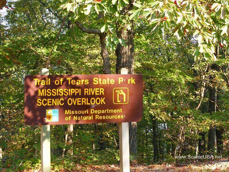
TRAIL OF TEARS STATE PARK
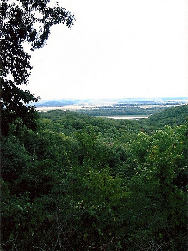
The tragic history that gives Trail of Tears State Park its name provides a sharp contrast to the peaceful, serene setting and the abundance of recreational opportunities enjoyed by visitors today. The 3,415-acre park is a memorial to the Cherokee Indians that lost their lives in a forced relocation, as well as a place for visitors to participate in a variety of outdoor adventures.
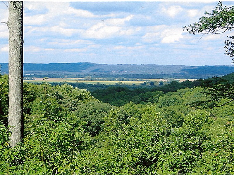
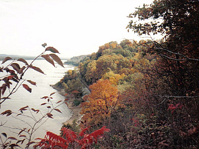
The park is located on the site where nine of 13 groups of Cherokee Indians crossed the Mississippi River in harsh winter conditions in 1838-39. Thousands lost their lives on the trail, including dozens on or near the park?s grounds. Legend says that Nancy Bushyhead Hildebrand died and was buried within the park?s boundaries. The Bushyhead Memorial is a tribute to all the Cherokee who died on the trail. The park?s visitor center features exhibits that interpret the forced relocation, as well as the park?s many natural features.
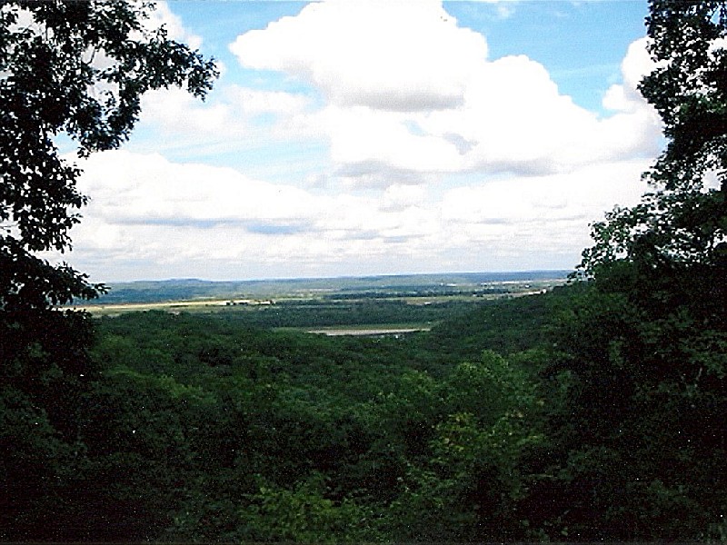
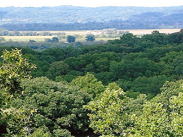
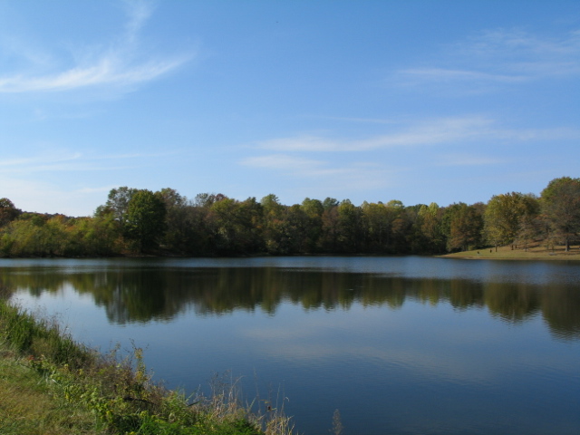
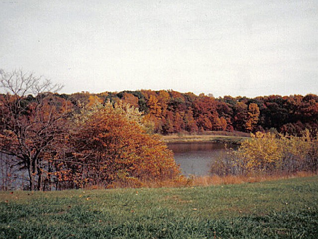
Today, numerous picnic sites are scattered throughout the park and campsites are available in a wooded area and near the river. Anglers can cast their lines in either the Mississippi River or the 20-acre Lake Boutin, stocked with bass, bluegill and catfish. The park?s numerous trails offer opportunities for hiking, backpacking, primitive camping and equestrian pursuits. In winter, the bluffs and cliffs along the river are noted as roosting sites for bald eagles.

Cottages and Cabins
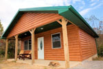
Doc's Lakeside Cabin was built in 2012 and is located in beautiful Southern Illinois. Let us welcome you to setting where you can rejuvenate your mind, body and soul.
8.2 miles from park*
Fishing
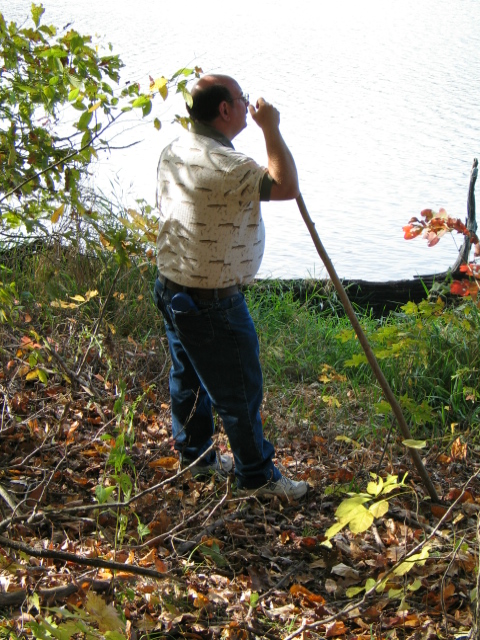
Anglers can cast their lines in the Mississippi River, which offers catfish, perch and carp. Twenty-acre Lake Boutin is stocked with bass, bluegill and catfish. Day usage is from 7 a.m. to 10 p.m. April through October; 7 a.m. to 9 p.m. November and March; and December through February 7 a.m. to 6 p.m. Sunday through Thursday and 7 a.m. to 9 p.m. Friday and Saturday. Visitors must have a valid Missouri fishing license in order to fish in these areas.
Trail of Tears State Park is located near Cape Girardeau, Jackson
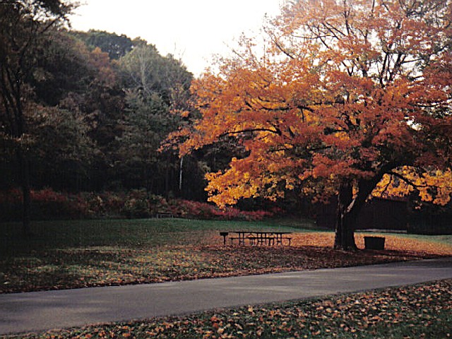
Numerous picnic sites are scattered throughout the park. There are also two picnic shelters available for use. If not reserved, the shelters are available at no charge on a first-come, first-served basis.
Greens Ferry Shelter is the smaller of the two shelters. This shelter is near the Bushyhead Memorial and can seat approximately 40 adults. It has vault toilets, a fireplace and six tables. It can be reserved for $25 per day.
Wescoat Shelter can seat approximately 100 people. It has modern restrooms, water, electricity, lights, two fireplace grills, 14 tables and a playground nearby. (Warning: has potential for flooding March - June). Wescoat Shelter can be reserved for $40 per day.
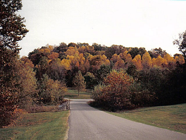
Trail of Tears State Park offers 14.5 miles of trail within the park's 3415-acres.
Peewah Trail -- 10 miles : Peewah is an Indian word meaning "come follow in this direction." This trail offers visitors access to the most remote areas of the park. Winding through Indian Creek Wild Area, this trail is approximately 10 miles long and is open to hikers, backpackers and equestrian riders. The trail is divided into four different sections by following various loops of the trail. The green section takes visitors to an overlook located along the Mississippi River and is approximately 1.5-miles round trip. The yellow loop is 3.4 miles and meanders along the Mississippi for a short distance. The red loop is a little under six miles.
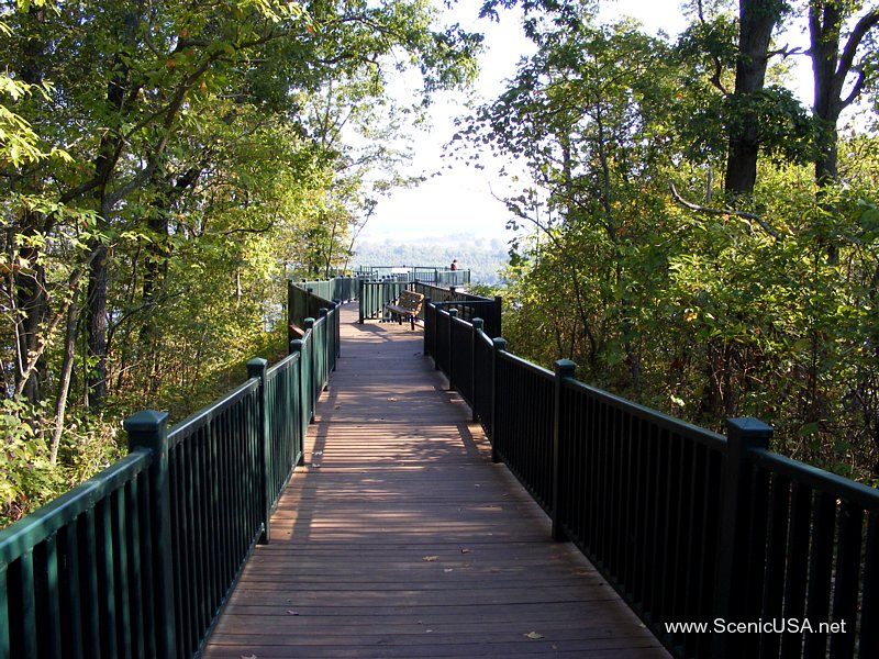
Sheppard Point Trail -- 2 miles : This trail is a two-mile loop trail that ascends to the top of a beautiful bluff overlooking the Mississippi River. The trail is considered difficult and is open only to hikers due to the rugged terrain.
Lake Trail -- 2 miles : The picturesque Lake Trail winds around the basic campground and along a portion of Lake Boutin for approximately two miles.
Nature Trail -- 0.5 miles : Nature Trail is the shortest trail in the park. Visitors have spotted white-tailed deer, cottontail rabbits and gray squirrels while hiking along this easy trail.
The park offers birding enthusiasts a chance to spot over 140 species, including warblers and waterfowl. The Mississippi Flyway migration route passes through the area, attracting numerous migratory birds. Birdwatchers can also find year-round residents like woodpeckers and hawks in the forested areas of the park.
Cottages and Cabins
Enjoy a getaway to nearby Southern Illinois with Shawnee National Forest Cabins. Rustic log cabin rentals with modern comforts such as hot tubs, Wifi and satellite TV located near Garden of the God in the Shawnee National Forest.
62.4 miles from park*

Cottages and Cabins
Tucked away in the picturesque rolling hills of Southern Illinois, our location rests on the highly acclaimed Southern Illinois Wine Trail. Pinnon Lake cabins are ten tranquil minutes from the edge of Shawnee National Forest. Moments from anywhere yet feels like miles from it all.
21.4 miles from park*
From St. Louis : Trail of Tears State Park is approximately two to two and one-half hours from the St. Louis area. Travel south on I-55 to Exit 105 (Fruitland/Jackson). Take Hwy. 61 north for approximately one mile. Turn right onto Hwy. 177 and continue for seven miles. At the four-way stop in front of the Proctor and Gamble Plant, turn right to stay on Hwy. 177. Continue on Hwy. 177 for another 2.8 miles. The entrance to the state park will be on the left right before the Hwy. 177/Route V intersection.
From Jefferson City : Trail of Tears State Park is approximately four hours from the Jefferson City area. Travel east on U.S. Hwy. 50 until it ends at I-44 (just past Union). Take I-44 east to Hwy. 141; proceed south to I-55. Take I-55 south Exit 105 (Fruitland/Jackson). Travel north on Hwy. 61 for approximately one mile. Turn right onto Hwy. 177 and continue for seven miles. At the four-way stop in front of the Proctor and Gamble Plant, turn right to stay on Hwy. 177. Continue on Hwy. 177 for another 2.8 miles. The entrance to the state park will be on the left right before the Hwy. 177/Route V intersection.
From Springfield/Joplin : Trail of Tears State Park is approximately five hours from the Springfield area. Travel east on I-44 to U.S. Hwy. 65. Take U.S. Hwy. 64 south to U.S. Hwy. 60. Travel east on U.S. Hwy. 60 to I-55 near Miner. Take I-55 north to Exit 105 (Fruitland/Jackson). Travel north on Hwy. 61 for approximately one mile. Turn right onto Hwy. 177 and continue for seven miles. At the four-way stop in front of the Proctor and Gamble Plant, turn right to stay on Hwy. 177. Continue on Hwy. 177 for another 2.8 miles. The entrance to the state park will be on the left right before the Hwy. 177/Route V intersection.
From Carbondale, Ill. : Trail of Tears State Park is approximately 2 hours 15 minutes from Carbondale, Ill. Travel south on U.S. Hwy. 51 to IL 146. Stay on IL 146 as it becomes Hwy. 34/74. Turn right onto Hwy. 177 and continue for 12.3 miles. At the stop sign at the junction of Hwy. 177 and Route V, turn right to stay on Hwy. 177. The entrance to the state park will be on the right almost immediately after turning onto Hwy. 177.
From Memphis, Tenn. : Trail of Tears State Park is approximately three and one-half hours from Memphis. Travel west on I-40 to I-55. Take Exit 277 toward Blytheville/Jonesboro and merge onto I-55 heading north. Continue on I-55 for 170 miles to Exit 105 (Fruitland/Jackson). Travel north on Hwy. 61 for approximately one mile. Turn right onto Hwy. 177 and continue for seven miles. At the four-way stop in front of the Proctor and Gamble Plant, turn right to stay on Hwy. 177. Continue on Hwy. 177 for another 2.8 miles. The entrance to the state park will be on the left right before the Hwy. 177/Route V intersection.


 Share Your Trail of Tears State Park Photos (click here)
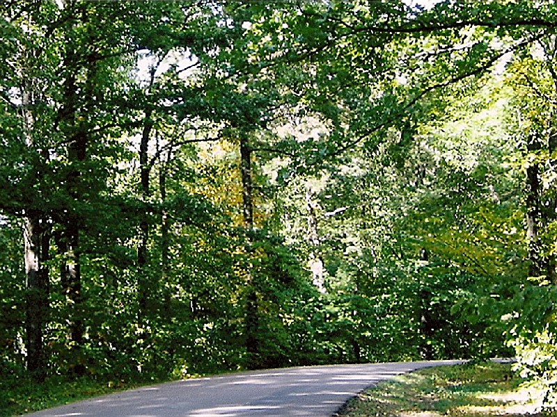